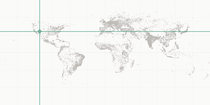
Grand Canyon (South Rim) lies at 36°03'15.84"N 112°08'24.36"W (decimal: 36.0544, -112.1401), in the temperate zone of the northern hemisphere. At roughly 2,072 m (6,798 ft) above sea level, altitude is a defining part of its geography. Local time follows the America/Phoenix timezone.
Grand Canyon (South Rim) in every coordinate format
| Format | Value |
|---|---|
| Decimal degrees | 36.054400, -112.140100 |
| DMS | 36°03'15.84"N 112°08'24.36"W |
| DDM | 36°3.2640'N 112°8.4060'W |
| UTM | 12S 397314E 3990584N |
| MGRS | 12S UE 97314 90583 |
| Plus Code | 85893V35+QX6 |
| Geohash | 9w2m05w04 |
Copy any value, or open the coordinate converter to transform it further.
Where this landmark sits on the globe
- Distance to the equator: 4,009 km
- Distance to the North Pole: 5,998 km · to the South Pole: 14,017 km
- Antipode (opposite point on Earth):
-36.0544, 67.8599— explore it with the antipode finder
Sunrise & sunset in Grand Canyon (South Rim) through 2026
Local times (America/Phoenix), computed astronomically for these exact coordinates:
| Date | Sunrise | Sunset | Day length |
|---|---|---|---|
| Jan 1 | 07:40 | 17:26 | 9 h 45 min |
| Feb 1 | 07:30 | 17:56 | 10 h 25 min |
| Mar 1 | 07:00 | 18:24 | 11 h 24 min |
| Apr 1 | 06:15 | 18:51 | 12 h 35 min |
| May 1 | 05:37 | 19:16 | 13 h 39 min |
| Jun 1 | 05:14 | 19:41 | 14 h 26 min |
| Jul 1 | 05:16 | 19:50 | 14 h 34 min |
| Aug 1 | 05:36 | 19:35 | 13 h 58 min |
| Sep 1 | 06:01 | 18:58 | 12 h 56 min |
| Oct 1 | 06:24 | 18:14 | 11 h 49 min |
| Nov 1 | 06:52 | 17:34 | 10 h 41 min |
| Dec 1 | 07:22 | 17:15 | 9 h 53 min |
For today's live values — including golden hour and moon times — use the sunrise & sunset tool.
Distances from Grand Canyon (South Rim)
| To | Distance | Miles | Initial bearing |
|---|---|---|---|
| London | 8,252 km | 5,128 mi | 37° NE |
| New York | 3,337 km | 2,074 mi | 69° ENE |
| Tokyo | 9,125 km | 5,670 mi | 309° NW |
| Sydney | 12,669 km | 7,872 mi | 244° WSW |
| Dubai | 13,076 km | 8,125 mi | 13° NNE |
| Singapore | 14,435 km | 8,969 mi | 310° NW |
| Los Angeles | 598 km | 372 mi | 250° WSW |
| Johannesburg | 16,100 km | 10,004 mi | 85° E |
Measure any other pair with the distance calculator.
Nearest places in this database
| Place | Distance | Bearing |
|---|---|---|
| Phoenix, United States | 290 km | 179° S |
| Tijuana, Mexico | 596 km | 230° SW |
| Los Angeles, United States | 598 km | 250° WSW |
| Hollywood Sign, United States | 601 km | 251° WSW |
| Ciudad Juárez, Mexico | 712 km | 131° SE |
Local time
Grand Canyon (South Rim) uses the America/Phoenix timezone (UTC-07:00 in January, UTC-07:00 in July) and does not observe daylight saving time.